|
|
Belize Posters, Prints, Charts, Maps & Books
curriculum enrichment resources for classrooms.
|
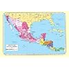
geography > North America > Central America > BELIZE < social studies
|
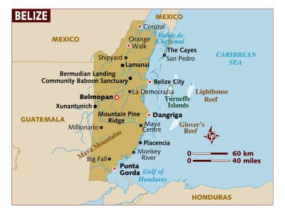
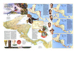
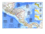
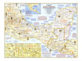
Belize, formerly known as British Honduras, is a small nation noted for its high biodiversity on the east coast of Central America on the Caribbean Sea. The country of Honduras is across the Gulf of Honduras to the east, Mexico is on Belize's northern border and Guatemala to the south and west. The border between Belize and Guatemala is in contineous dispute.
Belize is slightly smaller than the Commonwealth of Massachusetts, and has a flat coastal plain with low mountains in the south. The climate is tropical with the rainy season May to November; the dry season December to May. Belize has the longest barrier reef in the western hemisphere (2nd longest after the Great Barrier Reef, Australia). The islands just off the Belize coast are called “cayes” (pron. keys) which attract scuba diving tourists, an important factor in Belize's economics.
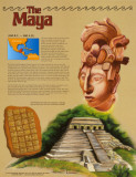
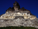
As early as 1638 shipwrecked English seaman and British privateers made settlement on the coast of this Mesoamerican area which was home to the Mayas, a Pre-Columbian agrarian culture that extended throughout northern Central America and the Yucatan peninsula. The Mayan ruins are a tourist destination and becoming an important part of Belize's economics that previously relied on banana, citrus and sugar crops.
Belize became independent of Britain 1981. As a parliamentary democracy and constitutional monarchy, Belize recognizes Queen Elizabeth II head of state.
The capital of Belize was moved to the centrally located Belmopan after Hurricane Hattie caused significant damage to the country, and Belize City, in 1961. Belize citizens over 18 are granted universal sufferage.
|
|
|
|
Belize - Important Maya archaeological sites and the hemisphere's longest barrier reef attract much needed tourism to this sparsely populated land of tropical rain forest and savanna. With virtually no heavy industry and most of its land uncultivated, Belize welcomes immigrants. Situated between Mexico, Guatemala, and the Caribbean Sea, the country was under British rule until 1981. Today Belizeans continue to welcome British military protection, since Guatemala claims the land as its inheritance from Spain. Text and statistics as of 1986.
|
|
|
|
|
|
|
|
|
|
|
|
|
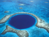
A blue hole, a submarine cave or sinkhole, are roughly circular, steep-walled depressions named for the dramatic contrast between the dark blue, deep waters of their depths and the lighter blue of the shallows around them. Belize's Blue Hole is the 2nd largest in the world after a blue hole in the Bahamas.
|
|
|
|
|
|
|
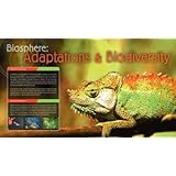
Biosphere: Adaptations & Biodiversity
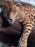
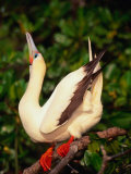
Poster Text: An adaption is a change in the structure or function of an organism which allows it to thrive within its environment. It may take physical adaptation such as the size or shape of the organism or it way in whch its body works. It may also be a change in an animals behavior. Adaptation is produced through the process of natural selection. As the environment changes, organisms that cannot adapt eventually die. Individuals with the ability to adapt produce more successful offspring. These offspring may carry the adaption forward until the whole species contains organisms which are adapted to the new environment.
An organism's environment consists of many important element whcih can influence adaption. Whether the climate is hot, cold, dry or wet will have an effect on all creatures that live in that environment. The presence of predators will also have an effect. Prey animals must learn to defend themselves or become adept at escaping predators.
• more Eco-sphere posters
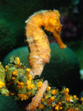
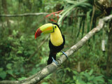
• Biodiversity in Belize
|
|
|
|
|
previous page | top
|
|
I have searched the web for visual, text, and manipulative curriculum support materials - teaching posters, art prints, maps, charts, calendars, books and educational toys featuring famous people, places and events - to help teachers optimize their valuable time and budget.
Browsing the subject areas at NetPosterWorks.com is a learning experience where educators can plan context rich environments while comparing prices, special discounts, framing options and shipping from educational resources.
Thank you for starting your search for inspirational, motivational, and educational posters and learning materials at NetPosterWorks.com. If you need help please contact us.
|
|
|