|
|
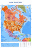
North America Posters, Prints, Charts, Photographs & Maps
for educators and home schoolers.
|
world geography > NORTH AMERICA < social studies
|
|
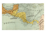
 The Americas, often refered to as the “New World”, are the continents occupying the western hemisphere of Earth. North America is in the northern hemisphere with the nations of Canada, Mexico, and the United States. Connected to South America at the Isthmus of Panama, the land mass known as Central America (between the Isthmuss of Tehuantepec and Panama) is generally included with North America. The Americas, often refered to as the “New World”, are the continents occupying the western hemisphere of Earth. North America is in the northern hemisphere with the nations of Canada, Mexico, and the United States. Connected to South America at the Isthmus of Panama, the land mass known as Central America (between the Isthmuss of Tehuantepec and Panama) is generally included with North America.
As the third largest continent in area (after Asia and Africa) and the fourth largest in population (after Asia, Africa and Europe), North America is bounded on the north by the Arctic Ocean, the east by the North Atlantic Ocean, the west by the North Pacific Ocean and the south by the Caribbean Sea.
The vast North American continent is experiencing the effects of global warming in the subsiding of melting tundra of the Arctic and retreating glaciers in Montana and the Canadian Rockies, to the coral reef bleaching in lush sub-tropics of Florida, the Caribbean and Bermuda, along with animal habitat loss in California and marsh loss in the Chesapeake Bay.
Geography, the scientific study of the Earth's physical features, resources, climate, and human interventions. The word derives from the Greek words ge ( Earth ) and graphy (“to write,” as in “to describe”).
|
|
|
|
|
|
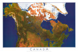
Canada, as the world's second-largest country by total area, occupies most of northern North America. Canada extends from the Atlantic Ocean to the Pacific Ocean and northward into the Arctic Ocean. Canada's land borders are with the United States along the south and to the northwest with Alaska.
|
|
|
|
|
|
|
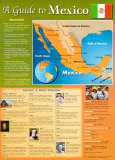
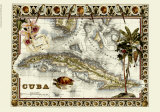
Mexico Posters
Officially known as the United Mexican States, Mexico is the 15th largest country by area and the most populous Spanish speaking country in the world.
Located in southern North America, Mexico is the furthest north and west country of Latin America, those countries where languages derived from Latin (the Romance languages) are spoken (as opposed to Anglo America where the languages from Germanic roots are spoken).
|
|
|
|
|
|
|
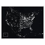
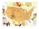
Cities of the Americas
The North America at Night poster is a mosaic of US Air Force weather satellite images. This night time shot shows just how urbanized North America is and what natural features are seen from space. It extends from Canada to the Caribbean and from Hawai'i (inset) to New England and reveals a unique perspective of North America. This makes a perfect classroom reference for geography, economics, demography, and environmental science.
|
|
|
|
|
|
|
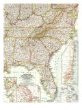
Map of South Eastern United States
• more maps
|
|
|
|
|
|
 |
Salt Pan Near Badwater, Death Valley- Lowest Point in North America, 282 ft below sea level, Photographic Print
available at-
AllPosters.com
|
|
 |
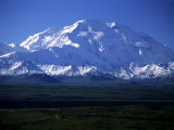
National Parks
Grand Canyon poster and more...
|
|
 |
Rivers of the World Posters
|
|
 |
Continents Posters
Asia, Africa, North and South America, Europe, Australia, Antarctic |
|
|
|
|
|
|
|
previous page | top
|
|
I have searched the web for visual, text, and manipulative curriculum support materials - teaching posters, art prints, maps, charts, calendars, books and educational toys featuring famous people, places and events - to help teachers optimize their valuable time and budget.
Browsing the subject areas at NetPosterWorks.com is a learning experience where educators can plan context rich environments while comparing prices, special discounts, framing options and shipping from educational resources.
Thank you for starting your search for inspirational, motivational, and educational posters and learning materials at NetPosterWorks.com. If you need help please contact us.
|
|
|