|
|
Deserts of the World Posters, Prints, Charts
for environmental, ecology, and geography educators & classrooms, travelers.
|
|
educational posters > geography > landforms > deserts < social studies
|
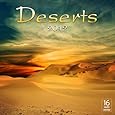
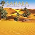
A desert, with its very dry environment with extreme temperatures, has limited animal and plant life. The biggest desert: Sahara (Africa); driest: Atacama (Chile) and Lut (Iran); coldest: Gobi (Asia) and the desert on the Antarctica continent.
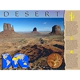
Poster Text: Deserts are harsh environments found all around the world, covering about one-fifth of the planet. Characterized by low rainfall, deserts receive less than 25 centimeters of rain per year. While most are swelteringly hot, such as the Australian Desert, a few, like the Gobi Desert in Asia can get very cold. Desert temperatures might also drop at night, and can plunge below freezing during the winter season. Despite the lack of water and other extreme conditions, most deserts are home to many species of plants and animals.
Life native to the desert is highly specialized and well-adapted to the extreme climate. Sagebrush, short grasses, creosote bushes and cacti are just a few of the plants found there. Desert plants have root and water storage systems ideal for minimizing moisture loss. Within hours of rainfall, desert plants bloom, reproduce, and store water needed for the coming drought.
The desert is home to many reptiles, insects, birds and some small mammals, such as the kangaroo mice in North America. The animals surviving in the desert have evolved perfectly to suit the climate. Most desert animals are nocturnal, sheltering themselves from the sun during the day, either in shade or burrows. A unique physical adaptation is the storage of fat in humps or tails, rather than throughout the body, as fat causes heat to intensify. The absence of sweat glands, and the concentration of urine are other physical adaptations.
|
|
|
Antartica is technically the largest desert in the world even though about 70% of the world's fresh water is locked up there as ice.
• more Antarctic posters
|
|
|
|
|
|
Arabian Desert occupies most of the Arabian Peninsula (900,000 square miles or 2,330,000 square kilometers) and the Kingdom of Saudi Arabia; it also includes Yemen, Oman, Jordan and Iraq.
The Rub'al-Khali, one of the largest continuous bodies of sand in the world, covers the southern third of the penisula, is also one of the most oil rich regions of the world.
|
|
|
|
|
Atacama Desert in Chile, the driest desert in the world, gets a double "rain shadow" effect from the high pressure over the Pacific to the west and Andes Mountains to the east.
The Atacama has the world's largest deposit of natural sodium nitrate, "saltpeter", that had been mined significantly until the a synthetic nitrate was invented. Now, because of the high elevation, cloud free sky, and low population (no radio interference) several astronomical observatories are located in the Acatcama. Also the North-South Pan American Highway runs through the Atacama.
|
|
|
|
|
Bardenas Reales in Navarre, Spain
|
|
|
|
|
The vast Chihuahuan Desert stretches from a small area of southeastern New Mexico and extreme western Texas into a vast area of Mexico.
|
|
|
|
|
The Gobi, the largest desert in Asia, and 4th largest in the world, covers parts of China and southern Mongolia. The lack of precipitation that created the Gobi is caused by the "rain shadow" effect of the Himalaya Mountains.
Ray Chapman Andrews lead an expedition into the Gobi in which palentologist Teilhard de Chardin participated.
|
|
|
|
|
The Great Basin Desert is contained within the Great Basin watershed area of the western United States between the Wasatch Mountains and the Sierra Nevada. While exact boundaries defy establishment, the Great Basin Desert covers much of northern Nevada, western and southern Utah, the southern third of Idaho, the southeastern corner of Oregon, and melds into Colorado and Wyoming. The Mojave Desert is within the watershed of the Great Basin, as is the Great Salt Lake.
|
|
|
|
|
Highlands of Iceland, Hálendi, Desert
|
|
|
|
|
The Kalahari Desert is not a true desert. It is an arid to semi-arid sandy area of 362,500 sq. mi. (900,000 km), consisting of much of Botswana and parts of Namibia and South Africa; the surrounding Kalahari Basin extends further into neighboring Angola, Zambia and Zimbabwe. The Okavango River flows into a wildlife rich delta and after good rains the Kalahara has huge areas of excellent grazing. The 1980s movie, The Gods Must Be Angry was about a native Bushman's encounter with the western world.
|
|
|
|
|
Libyan Desert
|
|
|
|
|
The Mojave Desert covers portions of California, Utah, Nevada, and Arizona. Named for the Mohave Indians (both spellings are correct), the boundaries of the Mohave are indicated by the presence of Joshua trees (Yucca brevifolia), whose uplifted branches reminded the Mormon pioneers of the biblical figure Joshua. Death Valley, the lowest & hottest place in North America is in the Mohave, as is Las Vegas, NV. Some do not consider the Mojave a separate desert but a transition between the Great Basin Desert the the north is and to the south and east is the Sonoran Desert.
|
|
|
|
|
Namib Desert
|
|
|
|
|
Negev Desert - Israel
|
|
|
|
|
Nubian Desert
|
|
|
|
|
Patagonia, the largest desert in the Americas and the 5th largest in the world (260,000 sq mi / 673,000 km), is also known as the Patagonian Steppe. A cold winter desert in the rain shadow of the Andes Mountains, Patagonia is located primarily in Argentina, with small parts in Chile. The name seems to come from the European explorers (average height 5'1" tall) who experienced the natives average height of 5'11", as giants.
|
|
|
|
|
Rangipo Desert
|
|
|
|
|
The Sahara, the largest desert in the world, covers much of northern Africa. On the west is the Atlantic Ocean and the Atlas Mountains, the Mediterranean Sea on the north, the Red Sea and Egypt on the east and the Niger River on the south.
The Sahara is so large that regions are further identified: the Nubian Desert of Sudan, is in the eastern region between the Nile and Red Sea; the Libyan Desert is in southwestern Egypt, eastern Libya and western Sudan; the Tenere Desert
Dunes, bodies of sand shaped by wind, are iconic of the Sahara and are called "erg", stone plateaus / "hammada", gravel plains / "reg", dry valley / "wadi", and salt flats / "shatt"; an oasis occurs where underground water, an aquifer, is close to the surface. Along parts of the northern edge is a narrow Mediterranean climate; the southern transition area of the Sahara is called the Sahel.
|
|
|
|
|
Sonoran Desert
Saguaro National Park
Sonora is a Spanish word which means loud, clear, sonorous, harmonious and audible. It also means ground snakes. According to 1990 census, Sonora is a very rare first name of females as well as last name in the United States of America. Sonora is also the name of a desert near phoenix, an island, a peak, a river, a city in the states of Ohio, California, Kentucky and Texas USA.
It is also a state in North-western Mexico and its capital is Hermosillo. Meteorologically, Sonora is also the name of a thunderstorm which occurs in the mountains and deserts of Southern California and Baja California during the summer season. Sonora is also the name of a western movie which was made in the year 1969.
|
|
|
|
|
The Tabernas Desert of southeastern Spain is in the "rain shadow" of the Sierra de los Filabres and the Sierra de Alhamilla to the south, in the Andalucia region.
The Tabernas "badlands" topography so resembles the America West that the desert became the location of many spaghetti westerns like "A Fistful of Dollars".
|
|
|
|
|
Taklamakan is a sandy, cold desert in the heart of Asia. Merchants avoided direct crossing by using branches of the Silk Road that skirted the desert's northern and southern edges.
Swedish explorer Sven Anders Hedin disovered the ruins of the ancient town Taklamakan town of Lou-lan on one of his many expeditions.
|
|
|
|
|
Thar Desert (Great Indian Desert), in the northwestern part of the Indian subcontinent, lies in India and Pakistan, with the Indus River to the west, the Aravalli Range to the east and a salt marsh called the Rann of Kutch.
Theories of the origin of the Thar Desert suggest that relatively recent plate tectonic action altered the flow of the Ghaggar river, turning the area into a desert.
|
|
|
previous page | top
|
|
I have searched the web for visual, text, and manipulative curriculum support materials - teaching posters, art prints, maps, charts, calendars, books and educational toys featuring famous people, places and events - to help teachers optimize their valuable time and budget.
Browsing the subject areas at NetPosterWorks.com is a learning experience where educators can plan context rich environments while comparing prices, special discounts, framing options and shipping from educational resources.
Thank you for starting your search for inspirational, motivational, and educational posters and learning materials at NetPosterWorks.com. If you need help please contact us.
|
|
|