GEOGRAPHY

Africa
Algeria
Angola
Benin
Botswana
Burkina Faso
Burundi
Cameroon
Cape Verdi
Central African Rep
Chad
Comoros
Congo
Cote d'Ivoire
Djibouti
Egypt
Equatorial Guinea
Eritrea
Ethiopia
Gabon
Gambia
Ghana
Guinea
Guinea-Bissaau
Kenya
Lesotho
Liberia
Libya
Madagascar
Malawi
Mali
Mauritania
Mauritius
Morocco
Mozambique
Namibia
Niger
Nigeria
Reunion
Rwanda
Sao Tome
& Principe
Senegal
Seychelles
Sierra Leone
Somalia
South Africa
Sudan
Swaziland
Tanzania
Togo
Tunisia
Uganda
Western Sahara
Zambia
Zimbabwe
Antarctica
Asia
Australia
Caribbean/West Indies
Central America
Cities
Europe
Explorers
Geographers
Landforms
Maps
Middle East
National Parks
North America
South America


AFRICA
CALENDARS

Women of the African Ark Calendars
Women of the
African Ark
Calendars


Africa Calendars
Africa Calendars


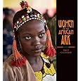
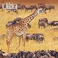
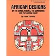
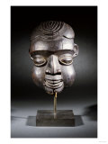
BOOKS ABOUT AFRICA & CAMEROON

Culture and Customs of Cameroon


From Cameroon to Paris: Mousgoum Architecture In and Out of Africa

African Designs of the Congo, Nigeria, the Cameroons and the Guinea Coast

Eyewitness Africa
Eyewitness: Africa


Teacher's Best - The Creative Process


Cameroon Posters, Prints, Charts, Maps
teaching resources for social studies and geography classroom, home schoolers, travelers


geography > Africa > CAMEROON < social studies


Cameroon Maps
Cameroon Map

(3º52'0"N 11º31'0"E)

Cameroon Flag
Cameroon Flag


Africa, Its Political Development Map 1980, Giclee Print
Africa, Its Political Development Map 1980,
Giclee Print

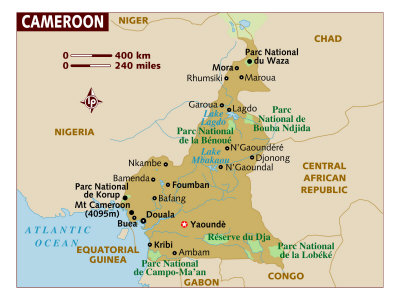
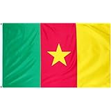
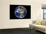
The Republic of Cameroon, located in central and western Africa, is home to over 200 different ethnic and linguistic groups, however the name Cameroon comes from the 15th century Portuguese explorers who named the area - Rio dos Camarões (“River of Prawns”).

Cameroon is bordered by Nigeria is to the west, Chad to the northeast, the Central African Republic to the east, and Equatorial Guinea, Gabon, and the Republic of the Congo to the south. Cameroon's coastline lies on the Bight of Bonny, part of the Gulf of Guinea and the Atlantic Ocean.

Cameroon is rich in geological and cultural diversity: natural features include beaches, deserts, mountains, rainforests, and savannas.

In the African colonial period the area was claimed by Germany in 1884 and later divided by England and France after Germany's defeat in WWI. Cameroon gained independence respectively in 1960 and 1961. English and French are the official languages,

Yaoundé is the capital and Douala is the largest city. While Cameroon is relatively stable compared to other African countries, many people live in poverty and corruption is widespread.


Elephant in Vaza National Park, Cameroon, 1987, Photographic Print
Elephant in Waza National Park, Cameroon, 1987,
Photographic Print

(11º20'0"N 14º44'0"E)

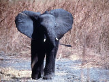
The Waza National Park, in far northern Cameroon, began as a hunting reserve in 1934, and evolved into a national park and then received a UNESCO biosphere reserve designation in 1979. Poachers are decimating the animals in the park.

• more national parks posters


Chutes De La Lobe, Kribi, West Coast, Cameroon, Africa, Photographic Print
Chutes de la Lobe, Kribi,
West Coast, Cameroon, Africa,
Photographic Print

(2º56'6"N 9º54'36"E)

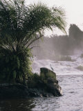
The dominant geographical feature of Cameroon is the South Cameroon Plateau. The rapids and waterfalls on the Lobé River near the seaport and beach resort of Kribi, are formed as the plateau gives way to the coastal plain.

Cameroon, West Africa: Post on the Seacoast, Probably at Douala, Photographic Print
Douala, Cameroon, Africa,
Photographic Print

(4º3'0"N 9º42'0"E)


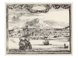
Douala is the largest city in Cameroon.

A Fine Bamenda Highlands Helmet Mask, Western Grasslands, Cameroon
Bamenda Highlands Helmet Mask, Western Grasslands, Cameroon
Giclee Print

• more masks posters

Ashanti Doll, Zulu Horn and Necklace, Yoruba Iron Instrument and Flask, Cameroon, Africa, Photographic Print
Ashanti Doll, Zulu Horn and Necklace, Yoruba Iron Instrument and Flask, Cameroon, Africa,
Photographic Print


A Vine Bridge Resembling a Spiders Web Near Mamfe, Mamfe, Sud-Ouest, Cameroon, Photographic Print
A Vine Bridge Resembling a Spiders Web Near Mamfe, Mamfe, Sud-Ouest, Cameroon,
Photographic Print

Vine Bridge


Full Earth Showing Africa, During Day, 8/7/2001, Wall Mural
Full Earth Showing Africa,
During Day, 8/7/2001,
Wall Mural

• more Earth from Satellite Posters
Black History Posters


African Animals Poster
African Animals
Poster

African Animals

mammals posters


previous page | top

I have searched the web for visual, text, and manipulative curriculum support materials - teaching posters, art prints, maps, charts, calendars, books and educational toys featuring famous people, places and events - to help teachers optimize their valuable time and budget.

Browsing the subject areas at NetPosterWorks.com is a learning experience where educators can plan context rich environments while comparing prices, special discounts, framing options and shipping from educational resources.

Thank you for starting your search for inspirational, motivational, and educational posters and learning materials at NetPosterWorks.com. If you need help please contact us.


NPW home | Global PathMarker Collection | APWTW Blog | faqs-about | contact | search | privacy
links for learning & curriculum ideas | bookshelves | toybox | media | ecards | quotes

NetPosterWorks.com ©2007-2015 The Creative Process, LLC All Rights Reserved.

last updated 12/2/13