|
|
|
|
|
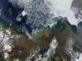
The Mackenzie River originates at Great Slave Lake, in the Northwest Territories of Canada, and flows north into a vast delta of thousands of channels before emptying into the Beaufort Sea of the Arctic Ocean. The Mackenzie Delta is the site of the Mallik methane hydrate field.
It is the longest river in Canada (1,738 kilometres/1,080 mi) and, the second longest river in North America (4,241 kilometres/2,635 mi) in length when its tributaries of the Peace and Finlay rivers are included.
The Mackenzie is open to navigation from May to October, the rest of the year portions of it serve as an “ice road”.
The river is named after the Scottish explorer Alexander Mackenzie, who travelled the river while trying to reach the Pacific Ocean in 1789. He called the waterway Disappointment River.
|
|
|
|
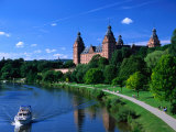
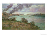
The Main River in Germany is one of the largest tributaries of the Rhine, and an important part of the transportation route link from the North Sea to the Black Sea.
|
|
|
|
The Marne, which is a tributary of the Seine, was the site of two World War I battles.
|
|
|
|
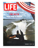
The Mekong River is the 12th-longest river in the world, and 7th longest in Asia. Due to many falls and rapids the Mekong has limited navigation. The endangered “fishing cat” is native to the Mekong River.
Cambodia's capital and largest city, Phnom Penh, is located on the Mekong.
• Vietnam War posters
|
|
|
|
|
|
|
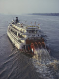
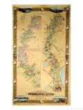
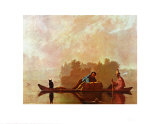
The Missouri River, flowing 2,341 miles (3,767 km) through the central United States, is a tributary of the Mississippi River. It is the longest river in North America and drains the third largest area, though only the thirteenth largest by discharge. Measured from its farthest source in southwestern Montana to the Mississippi's mouth at the Gulf of Mexico, the Missouri forms part of the world's fourth-longest river system.
The Missouri's watershed encompasses over two-thirds of the American Great Plains east of the Rocky Mountains, spanning parts of ten U.S. states and two Canadian provinces.
The first known Europeans to see the river were the French explorers Louis Jolliet and Father Jacques Marquette in 1673. The Lewis and Clark Expedition (1804–1806), the first United States expedition to the Pacific Coast, used the Missouri River for much of the journey.
Cities along the main stream: Great Falls, Sioux City, Omaha, Kansas City, and St. Louis, are part of the basin's population of ten million (c. 2011).
A great number of dams have been built along the Missouri River, making it into one of the largest reservoir systems of North America.
• State of Missouri posters
|
|
|
|
previous page | top | next
rivers | a-b | c | d | e-f-g-h-i-j | k-l | M | n | o | p | q-r | s | t-u-v | w-x-y-z
|
|
I have searched the web for visual, text, and manipulative curriculum support materials - teaching posters, art prints, maps, charts, calendars, books and educational toys featuring famous people, places and events - to help teachers optimize their valuable time and budget.
Browsing the subject areas at NetPosterWorks.com is a learning experience where educators can plan context rich environments while comparing prices, special discounts, framing options and shipping from educational resources.
Thank you for starting your search for inspirational, motivational, and educational posters and learning materials at NetPosterWorks.com. If you need help please contact us.
|
|
|