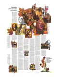
* Lesson plan idea - have your students update the information and latest statistics concerning the Mid-Atlantic states of Maryland, Virginia, Delaware, West Virginia, and the District of Columbia; discuss, contrast and compare the political, economic (employment), and environmental (climate change) situations of the area. • maps
Beckoning land beside bay and sea -
Capt. John Smith summed it all rather neatly when he wrote of his findings on a 1608 expedition from Jamestown, Virginia: “Here are mountaines, hils, plaines, valleyes, rivers and brookes all running most pleasantly into a faire Bay compassed but for the mouth with fruitfull and delightsome land.”
Smith was describing the Chesapeake Bay region he explored in an open boat. But his words aptly limn the “most pleasant” Middle Atlantic States.
Appalachian Highlands rib Virginia and West Virginia with luring resources. Rivers tumble over a land shelf to create falls and waterpower that early made Delaware an industrial state. Lifeways are shaped by two great bays, Chesapeake and Delaware – bays born of glaciers, though the ice sheets never reached that far. On their melting, seas rose to drown vast valleys (rias).
Rich in history and scenic beauty, the region also charms with “delightsome” touches. Apple-blossom festival or crab feast, trips down roaring rivers or into coal mines, wild-pony roundups or jousting tournaments, row-house doorsteps that Baltimore residents can upend when they don't want to be distrubed – the assortment is endless.
Here are “fruitfull” states for you to enjoy; you'll find their doorsteps always right side up for visitors.
WEST VIRGINIA - West Virginians protest chiches that label their state nothing but coal mines and hillbillies. Yet at the same time they lure visitors with such items as sight-seeing trips into coal mines, buildings made of blocks of coal, coal jewelry, scenic backcountry parks, outdoor dramas about hill-folk ways.
Still, West Virginians have a point. Far more than is covered by the chiches attracts travelers to what has been called “the most southern of the northern, the most northern of the southern ... the most western of the eastern, and the most eastern of the western States.”
Two major geographical sections mark this teapot-shaped region that well deserves it “Mountain State” nickname. Along the eastern third lie the washboard ridges of the Appalachian Mountain system. Hills and hollows of the Appalachian Plateau spread a maze over the western two-thirds.
This plateau section slopes toward the Ohio River – and in early days forged links with the Ohio and the Mississippi and the West. Eyes still turn that way. Here, too, a quirk of statecraft left a tie to the North. William Penn's grant called for a boundary extending five degrees west of the Delaware River. This stopped just short of the Ohio, creating West Virginia's narrow panhandle that stabs past Pittsburgh, Pennsylvania, and to within 90 miles of Cleveland, Ohio. The strip echoes the industrial aura of the two metropolises – and of the pre-Columbian culture that built a great burial knoll at Moundsville.
Another boundary-line oddity gave West Virginia an eastern panhandle, squeezed at one spot to an eight-mile neck of land. In this region Harpers Ferry of John Brown fame played its strategic role in the Civil War.
At Harpers Ferry the Potomac and Shenandoah Rivers join in a gorge Thomas Jefferson described as “one of the most stupendous scenes in nature.” But nature excels elsewhere, too; on a drive from Harpers Ferry to the state capital at Charleston you pass within 20 miles of no less tahn 14 state parks, each with its own brand of beauty. Two wilderness spots, Cranberry Blades and Dolly Sods – the latter named for a pioneer family, the Dahles, who once farmed its meadows, or “sods” – offer out-of-place touches of arctic tundra.
Major highways nosing across West Virginia ease its former isolation. But plentiful byways still make a shunpiker's dream. They lead into deep valleys where weathered houses spawn rusting jalopies beside porches – and TV antennas from rooftops. They wander wooded hills – nearly three-fourths of the state is covered with forests. They skirt coal towns and strip mines – four out of five counties are underlain with minable seams. And they unfold a prodigious array of other attractions. (*review the labor and environmental cost of coal and the practice of fracking.)
At Cass you can ride an old steam train on a 22-mile run – magnificent when automn paints the trees. At Green Bank you can listen to radio signals from the sun gathered by huge dishpan antennas of the national Radio Astonomy Observatory. Bluefield touts its mild summer climated by promising free lemonade any day the temperature hits 90ºF. Along the Tug Fork you can visit the valley the Hatfields and McCoys made famous with their feud.
Diversity? Yes, but a mere sampling of the state that calls itself “wild, wonderful West Virginia.”
WASHINGTON, DC - Washington, D.C. has been described as “a city within a capital, never a capital within a city.” The distinction carries a volue of meaning. And its name doubles for the District of Columbia –68.2 square miles carved for the federal seat beside the Potomac.
Perhaps no other place in the world offers so much to see and do. Here are fonts of our three-part government you literally step into – the White House, the Capitol, the Supreme Court. Here is a Library of Congress that is the world's largest treasure-house of knowledge, a Smithsonian Institution monumental in its displays, nature trails in a 29.3-mile-long park, cricket matches, embassies, chic Georgetown – variety in rich array.
And that's the problem. The temptation is to run from shrine to government building to museum to see everthing in a short visit. It can't be done. Pace yourself. Come again. ...
VIRGINIA - “I have been planning what I would shew you: a flower here, a tree there ... on this side a hill, on that a river. Indeed, madam, I know nothing so charming as our own country.” Thus wrote Thomas Jefferson in 1788. And ever since, Virginians have faced a similar dilemma" where to begin to show off their state.
For the “Old Dominion” has much with which to treat the visitor. And it goes to unusual lengths to spotlight its smorgasbord. The state operates information offices as key locations where motorists cross the border on major highways. Staffed year round the offices stock some 400 brochures describing Virginia attractions. ...
...
Virginia has been called “a thicket of history.” At Jamestown, the nation's story began, and reconstructed wattle-and-daub huts show you how those first settlers struggled throught the “starving time.” At restored Colonial Williamsburg and at Yorktown indelible moments in our past still ring. At Appomattox Court House another chapter came to an end. Little wonder highways bristle with historical markers to read.
The past still clings on Virginia's Eastern Shore, the 70-mile-long nib of the Delmarva Peninsula that the state shares with Maryland and Delaware. You can see buildings from the 1600s or hear on out-of-the-way Tangier Island English reminiscent of bygone centuries. Such provocative place-names as Mappsville, Modest Town, and Oyster dot the water-laced region.
An engineering tiumph, the Chesapeake Bay Bridge-Tunnel, connects the tip of the Eastern Shore to the Hampton Roads area. Here are playlands like Virginia Beach hard by a cluster of busy ports – Norfolk, Newport News, Hampton, Posrtsmouth; you can tour their sprawling U.S. Navy installations or take a harbor cruise where Monitor and Merrimack dueled. But the region also parades surprixes; acres of daffodils near Gloucester; 225,000 azaleas in Norfolk's Gardens-by-the-Sea; countryside where that “precisous stink.” tobacco, built such showcase plantations as Carter's Grove, Bereley, and Shirley.
The stretch that is central and northern Virginia offers overwhelming fare. Civil War buffs can pick from the likes of Manassas and Chancellorsville. Visitors with a Bicentennial bent can – for starters – range from Michie Tavern where James Monroe sipped to Richmond's St. John's Episcopal Church, where Patrick Henry spoke of liberty or death. Vacationists of other interests can find other mix: smart shops, Arlington's impressive National Cemetery, the Pentagon, concerts at sylvan Wolf Trap park, Waterfored's craft fair.
Appalachian hills lay a rumpled carpet along Virginia's spine. Here are highland crafts and music, resorts and rolling farmland, limestone cavern and apple orchards, state parks with such intriguing names as Natural Tunnel and Hungry Mother, the great trough that is the Shenandoah Valley. And anecdotes that reveal a great deal about history-rich Virginia: A visitor to Lexington, noting the Robert E. Lee Memorial Episcopal Church, commented with surprise because he thought Episcopal churches were named after saints.
“Oh, but is is,” came the reply.
MARYLAND - Cut almost in two by Chesapeake Bay, Maryland presents a split personality reflective of the divisions imposed by geography. The Eastern Shore – Maryland's part of the flat Delmarva Peninsula – maintains easygoing ways shaped by a heritage of agriculture and fishing and the isolation that until recent decades saw ferryboats as the main links across the bay. Busy central Maryland radiates from the metropolises of Baltimore and Washington. Hilly western Maryland strings as a panhandle, squeezed by the Potomac River and Mason's and Dixon's boundary into a strip only two miles wide at Hancock.
Traffic west funnels along that narrow strip, just as after the Revolutionary War pioneers streamed through a nearby mountain gateway – the Narrows on the outskirts of Cumberland. Spectactular in autumn color and spring bloom, the gorge channeled the old National Road, first U.S. highway built with federal funds. You can still see one of the stone bridges off U.S. 40 at Casselman State Park.
You can see, too, the Cumberland end of the Chesapeake and Ohio Canal, now a 184.5-mile-long national historical park restoring stretches of a waterway that bore traffic until the 1920s. And here in the western part of the state your chances are better for seeing the “glance of summer fire” that is Maryland's state bird, the Baltimore oriole.
Plumage of yellow-orange and black, colors of the Lords Baltimore who colonized Maryland, prompted the bird's name – not the city whose harbor makes it one of the world's great ports.
The British coveted that port in the War of 1812, and their shelling of Fort McHenry brought star-spangeld-bannered results. You can visit the fort today, along with the house where its flag was made, and also such Baltimore attractions as Babe Ruth's birthplace, Edgar Allan Poe's grave, white-scrubbed marble steps, scene-decorated window screens, fine restaurants.
Critic H. L. Mencken called Chesapeake Bay an “immense protein factory” that enabled Baltimoreans to eat divinely. Crabbing and other bay fisheries over the years have fashioned the delightful lifeways of dozens of waterfront towns – Oxford, Tilghman, St. Michaels, Chestertown, St. Marys City where Maryland's settlement began.
Bay boating has earned for Annapolis notoriety as the “Times Square of Yachting.” Pleasure craft crowd its harbor and byways, some of them sailed by visitors who come to walk the square-mile downtown section designted a national historic district. Colonial buildings charm, including the State House – oldest in the nation still in legislative use.
Maryland sweeps from Appalachia divide to the bustling beach of Ocean City and such lonely barrier isles as Assateague of wild-pony fame. It has tobacco auctions and waving corn, ski runs and covered bridges, maple-sap tapping and demonstrations of a working still. Eastern Shore towns offer assemblages of colonial homes. Ellicott City preserves the look of an 1800s mill town. Wildlife sanctuaries beckon. And oddities appeal: jousting tournaments where “knights” ride pell-mell to impale a suspended ring with their lances.
ABERDEEN: U.S. Army Ordnance Museum nearby. ANNAPOLIS: Capitol; U.S. Naval Academy. BALTIMORE: Harbor cruises; spice plant; Defender's Day. CUMBERLAND: Heritage Days. EMMITSBURG: Mother Seton shrine. FREDERICK: Francis Scott key tomb, Barbara Fritchie House; Hessian Barracks. LUTHERVILLE-TIMONIUM: State Fair. NEW MARKET: Antique shops. PERRY HALL: Jousting tournament. PORT TOBACCO: Colonial homes. SALISBURY: Wildfowl-decoy carving. SHARPSBURG: Antietan Battlefield nearby. ST. MICHAELS: Historic homes. UPPER MARLBORO, WALDORF: Tobacco auctions. WESTMINSTER: Farm museum.
DELAWARE - Nine miles across at its narrowest and hardly a hundred long, Delaware can be traveled in a hurry. But don't try. Unexpected diversity in this second smallest of states offers too much merely to be speed past.
Rolling hills terrace the northern portion, where a boundary quirk puts a bulge into Pennsylvania. That border line, spelled out in an early grant, is an arc of a circle who center first was specified as “ye end of ye Horse Dyke at New Castle.” Surveyors later made the measuring point the courthouse spire, so the boundary curves in a 12-mile radius from the building.
You can still wander through that venerable courthouse, restored today as a museum. New Castle itself is a delightful museum piece, with homes and buildings dating from the late 1600s and a town green decreed by Peter Stuyvesant, doughty Dutch governor of New Netherland. Stuyvesant wrested the area from Swedish colonists in 1655 – one of six changes of sovereignty the strategic port saw in its early days.
Eclipsed by the growth of other cities, New Castle was left with its 18th-century look. Today it proudly displays that heritage in a celebration the third Saturday each May. The rest of the year it reposes as a commuter suburb for Wilmington, industrial metropolis and headquarters for a host of corporations.
An accident of geography that put a great waterway beside hills where rivers make their last big plunge to sea level helped underpin the rise of such cities as Wilmington. On one such stream Eleuthere Irenee du Pont in 1802 founded the powder mill that became the chemical giant and family complex domination Delaware today.
At Wilmington's outskirts the Hagley Museum preserves early Du Pont mills and portrays the growth of American industry. Also near Wilmington stands Winterhur, former estate of the late Henry Francis du Pont, whoe showcase gardens and huge mansion draw throngs. The home's 100-odd rooms unfold a progression of American interiors and furnishings from the 1640s to the mid 1800s, authentic in minutest detail.
South of Wilmington the state spreads as a flatland of chicken and truck farms on the agriculturally rich Delmarva Peninsula. But it surprises, too, with 11 wildlife areas – haunts of deer, waterfowl, beaver, pheasant, and small game. And You'll find historic sites – among them Cooch's Bridge near Newark, where traditon holds the Stars and Stripes first flown in a Revolutionary War land battle, and Lewes, shelled by the British in 1813, and off whose cape Blackbeard and Kidd once sailed.
Delaware fronts the Atlantic with toasting bodies and plane-towed signs at such beaches as Rehoboth and Bethany. But all the strand is public, from Lewes to the Maryland line. That border has a fame of its own. Surveyors Charles Mason and Jeremiah Dixon laid most of it out in the 1760s to settle a dispute arising from grants to Lord Baltimore and William Penn. You can see one of the markers they set a few steps off state route 54 near Delmar.
DOVER: Capitol; John Dickinson Mansion nearby. FREDERICA: Barratt's Chapel, “cradle” of Methodism in the New World. HARRINGTON: State Fair. LEWES: Zwannendael Museum. ODESSA: Corbit-Sharp House and Wilson-Warner House. SOUTH BOWERS: Island Field, early Indian archeological site. WILMINGTON: Factory tours.