NetPosterWorks - Educational Posters selected for teachers by a teacher.


EDUCATIONAL, REFERENCE, &
CLASSROOM POSTERS INDEX -
art education & history
dance
early childhood
food & cuisine
geography
health & fitness
history
holidays
language arts & literature
math
motivational
music
notable people
peace education
pets & animals
theology
science
social studies
vocational education
Global PathMarkers
Free Poster Index
History of Posters


FAQS/ABOUT
SEARCH
CONTACT
LINKS FOR LEARNING
LESSON PLAN IDEAS
BOOKSHELVES
ECARDS


EUROPE CALENDAR
Europa Poster Calendar 2009


map mural

Map Wall Murals


Teacher's Best - The Creative Process


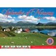
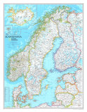
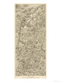
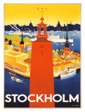
Scandinavia Posters, Print, Charts, Photographs & Maps
images for educators, home schoolers, theme decor for home and office.

educational posters > world geography > Europe > Scandinavia < social studies


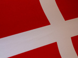
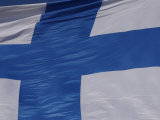
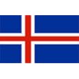
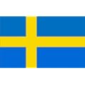
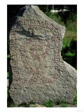
Scandinavia and Nordic are terms used to describe the cultural and geographic region of Northern Europe. The Scandinavian Peninsula includes the kingdoms of Norway and Sweden with a small portion of the Republic of Finland. The Kingdom of Denmark, the southernmost Nordic country, is located on the Jutland Peninsula. The Faroe Islands, a territory of Denmark, and Iceland are considered part of Scandinavia.


Map of Scandinavia Art Print
Map of Scandinavia
Art Print

Map of Scandinavia Art Print

EUROPEAN COUNTRIES
Albania
Andorra
Armenia
Austria
Azerbaijan
Belarus
Belgium
Bosnia &
Herzegovina
Bulgaria
Croatia
Cyprus
Czech Republic
Denmark
Estonia
Finland
France
Georgia
Germany
Greece
Hungary
Iceland
Ireland
Italy
Kazakhstan
Latvia
Liechtenstein
Lithuania
Luxembourg
Macedonia
Malta
Moldova
Monaco
Montenegro
Netherlands
Norway
Poland
Portugal
Romania
Russia
San Marino
Scotland
Serbia
Slovakia
Slovenia
Spain
Sweden
Switzerland
Turkey
Ukraine
United Kingdom
Great Britain
No. Ireland
Scotland
Wales
Vatican City


EUROPEAN GEOGRAPHY
TEACHING RESOURCES
An Historical Geography of Europe
An Historical Geography
of Europe

The Physical Geography of Northern Eurasia

Europe (Rookie Read-About Geography)
Europe
(Rookie
Read-About Geography)

Handy Geography Answer Book

Geography Coloring Book


Map of Norway Finland Sweden and Denmark, Giclee Print
Map of Norway, Finland, Sweden, and Denmark, Giclee Print

Map of Norway, Finland, Sweden, and Denmark,
Giclee Print


Denmark from Space, Art Print

Denmark


Denmark Flag, Photographic Print
Denmark Flag,
Photographic Print

Notable Danes
Hans Christian Andersen
Niels Bohr
Tycho Brahe
Henrik Dam
Hamlet
Soren Kieregaard
Lauritz Melchior
Asta Nielsen

Finland Flag, Photographic Print
Finland Flag,
Photographic Print

Finland

Notable Finns

Aino Ackte
Eero Saarinen
Jean Sibelius
Frans Eemil Sillapaa
Artturi Ilmari Virtanen


Norway Flag, Photographic Print
Norway Flag,
Photographic Print

Norway

Notable Norwegians
Roald Amundsen
Eric the Red
Kirsten Flagstad
Eduard Grieg
Knut Hamsun
Henrik Ibsen
Edvard Munch
Fridtjof Nansen
Sigrid Undset


Stone Wall and Cairns, the Arctic Circle, Norway, Giclee Print
Stone Wall and Cairns, the Arctic Circle, Norway,
Giclee Print


Sweden Travel Vintage Print
Sweden Vintage Travel Print

SWEDEN

Notable Swedes

Jons Jakob Berzelius
Anders Celsius
Christina of Sweden
Sven Anders Hedin
Ingrid Bergman
Greta Garbo
Dag Hammarskjöld
Selma Lagerlof
Jenny Lind
Carl Linnaeus
Christina Nilsson
Alfred Nobel
Henriette Sontag
Fredrika Stenhammar
Johan August Strindberg
Emanuel Swedenborg
Axel Hugo Teodor Theorell

FYI - Did you know Delaware was originally a Swedish colony?


Rune Stone Outside Gripsholm Castle, Giclee Print
Rune Stone
Outside Gripsholm Castle, Sweden,
Giclee Print

Runes are letters used to write Germanic languages prior to and shortly after the Christianization of the British Isles and Scandinavia.

Odin, the chief god in the Norse pantheon, is credited with the invention of runes; among his many roles is wisdom, death, and poetry.


Political Map of Europe Poster

Political Map of Europe Poster

Continent of Europe Wall Poster

Continent of Europe Wall Poster

• more Continent poster series


previous page | top


I have searched the web for visual, text, and manipulative curriculum support materials - teaching posters, art prints, maps, charts, calendars, books and educational toys featuring famous people, places and events - to help teachers optimize their valuable time and budget.

Browsing the subject areas at NetPosterWorks.com is a learning experience where educators can plan context rich environments while comparing prices, special discounts, framing options and shipping from educational resources.

Thank you for starting your search for inspirational, motivational, and educational posters and learning materials at NetPosterWorks.com. If you need help please contact us.


NPW home | Global PathMarker Collection | faqs-about | contact | search | privacy
links for learning & curriculum ideas | bookshelves | toybox | media | ecards

NetPosterWorks.com ©2007-2008 The Creative Process, LLC All Rights Reserved.

last updated 5/12/08