|
|
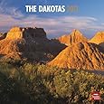
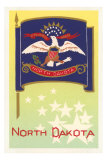
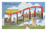
North Dakota Posters, Prints, Photographs, Maps, & Calendars
for educators, classrooms and themed decor in studio or office.
|
geography > NA > US > Mid-West > NORTH DAKOTA < social studies
|
|
North Dakota, known as the “Peace Garden State”, “Flickertail State”, and “Roughrider State” joined the Union on November 2, 1889 as the 39th state. “Dakota” is the Sioux word for “friend”.
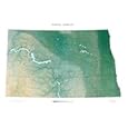
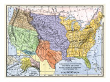
North Dakota, in the West North Central Region, is bordered on the north by Canadian provinces of Saskatchewan and Manitoba, the east by the state of Minnesota, the south by South Dakota, and the west by Montana.
|
|
|
|
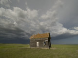
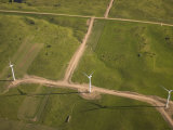
North Dakota doesn't trumpet its considerable assets; you must hunt them down: colorful late-summer country fairs in the rich eastern farm belt, more than 60 national wildlife refuges that protect everything from white pelicans to prairie chickens, huge recreational lakes create by the dammed-up Missouri River, cowboy and Indian lore still alive in the roundup and powwow.
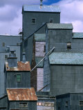
About a third of the state's 618,000 residents are of Scanadinavian descent. Ethnic touches of Norway and Germany were bequeathed by a parade of early settlers. The town of Mountain in the Red River Valley stages an Icelandic festival each August. That valley, once the bottom of a glacial-age lake, waves with seas of grain on fertile farms. The state traditionally ranks first or second in barley, flaxseed, wheat, and rye.
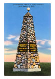
North Dakota shares 310 miles of border with Canada, and the crossing is easy. U.S. 281 and State 3 take you to the formally landscape Interational Peace Garden, a 2,300-acre monument to friendly U.S.-Canada relations and the site of summer concerts by students of a music camp there. The surrounding Turtle Mountains bristle with the state's only appreciable timberland and shelter a number of small lakes ideal for fishing, boating, and swimming.
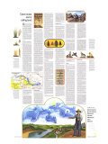
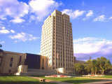
Two highways, State 1804 and 1806, bear numbers echoing dates of the Lewis & Clark expedition. When completed, the roads will trace the explorers' routes with a series of interpretive markers. It was in North Dakota that the expedition met the Indian woman guide Sakakawea, who stands in bronze beside Bismarck's 19-story capitol; from an observation floor you can see across the Missouri to old Fort Abraham Lincoln and to reconstructed earth lodges like those of the Mandan Indians with whom Lewis and Clark spent a winter.
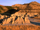
In the state's southwest corner lie the multicolored buttes, tablelands, and gorges of the Badlands. There a young Theodore Roosevelt punched cattle in the 1880s and celebrated his joy of wilderness. Now a national memorial park in his name preserves his cabin, hards of longhorns and buffalo, and 110 square miles of wild land. (poster text about North Dakota)
|
|
|
|
|
|
|
|
|
|
|
|
|
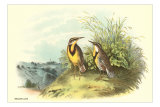
The Western Meadowlark is a medium sized songbird that ‘sports a yellow breast with a black bib over its mottled brown body’, has a permanent habitat in the grasslands and prairies, and forages on the ground and low vegetation for insects, seeds and berries. The Western Meadowlark is also the state bird of Kansas, Montana, Nebraska, Oregon, and Wyoming.
|
• more botany posters
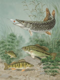
• more fish posters
• more bird posters |
|
|
|
|
|
|
|
|
|
|
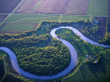
The Red River is usually slow and small, meandering northward toward Canada across the ancient lakebed. However, in the case of heavy snows or rains high water has to spread across the old lakebed in “overland flooding”. There have been a number of catastophic floods, recently 1950, 1997, 2009, and 2011, that are made worse by the snowmelt starting in the warmer south and the northward flowing waters are dammed by ice. • list of notable rivers
|
|
|
|
|
|
|
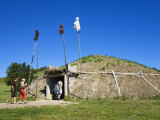
On-A-Slant Mandan Village (Mandan: Miti-ba-wa-esh) was established in the late 16th century and was inhabited until 1781 when a smallpox epidemic killed most of the villagers.
The original village had a high population of 1000-1500 people who hunted and farmed. The shelters were earthlodges which were held up by a frame of cottonwood logs and covered with layers of willow branches, grass, and earth. The thick walls insulated the lodge effectively in both summer and winter.
The village was located near the confluence of the Missouri & Heart Rivers; the name describes the ground that slants toward the river valley. The reconstruction is next to Fort Abraham Lincoln, that was once under the command of George Armstrong Custer.
• more Native American Cultures posters
|
|
|
|
|
|
|
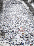
Some 2000 people flap their arms and legs, making angels in the snow at the Capitol in Bismarck, ND, on Saturday, March 23, 2002.
|
|
|
|
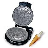
North Dakota had many pioneer settlers from Scandanavia and Germany. Among the favorite dishes in North Dakota is Krumkake, a Norwegian waffle cookie that are a traditional Christmas treat.
• food poster
|
|
|
previous page | top
|
|
I have searched the web for visual, text, and manipulative curriculum support materials - teaching posters, art prints, maps, charts, calendars, books and educational toys featuring famous people, places and events - to help teachers optimize their valuable time and budget.
Browsing the subject areas at NetPosterWorks.com is a learning experience where educators can plan context rich environments while comparing prices, special discounts, framing options and shipping from educational resources.
Thank you for starting your search for inspirational, motivational, and educational posters and learning materials at NetPosterWorks.com. If you need help please contact us.
|
|
|